
For this walking tour of the East End of London we’ll explore a vibrant place. Home to many people from all over the world and packed with history. The streets and buildings all having stories to tell. From the Huguenots to the Bengali’s the area has been the destination of choice for waves of immigration. This has helped to shape this areas unique character
It’s also the creative and cultural hub of London. In addition to history the area is known for being a world epicenter of high quality street art. There are galleries all over the place and historically the area was one of the places to be in Shakespearean London.
A Walking Tour of the East End of London
This walking tour will take you around some of the streets of the East End of London. The aim of the walk is to give a flavour of the history and culture of the area. This will incorporate as much as we can in order to give as wide a picture as possible.
- Start – Liverpool Street Station
- Finish – Liverpool Street Station
- Length of Time – 2 and a half to 3 hours
Liverpool Street Station to Spitalfields
Liverpool Street station is where we’ll start our walking tour of the East End of London. Opened in 1874 it suffered damage in both World Wars. It also played a major role as the terminus for thousands of Jewish children fleeing from war torn Europe. Those children, known as the Kindertransport, are commemorated with a statue at the front concourse of the station. This is where we will start the tour.

From the station turn left along Liverpool Street to the junction with the busy road of Bishopsgate. Keep an eye out for a plaque on the left hand side marking the site of the former Bethlehem Hospital, or Bedlam as it was better known. Once at the junction with Bishopsgate turn left and pass by another entrance to the station. Keep going until on the other side of the road you see the ‘Dirty Dicks’ public house. This stands on the corner of Middlesex Street where you need to go down.
Petticoat Lane
The street used to be called Petticoat Lane. There is a plaque detailing the history of the area at the entrance of the street. The famous Petticoat Lane Market still exists. A long running market selling clothes and textiles. It has it’s history in the textile industry of the area. In the 1830’s the name of the street was changed to denote the boundary between London and the county of Middlesex. Victorian sensibilities also couldn’t cope with a road name referencing undergarments.

Artillery Passage and Sandy’s Row
Keep going down the street until (after only a few yards) it forks. You need to stay on the left and head down Widegate Street. This leads straight to a little alley directly ahead called Artillery Passage. The area is packed with history and very atmospheric. It is alleged that Artillery Passage was used as an inspiration for one of the settings for Diagon Alley in the Harry Potter films. You’ll understand why when you go there. Separating the two lanes is a cross lane called Sandy’s Row. A slight detour to the left will take you to the Sandy’s row Synagogue. This is one of the oldest synagogues in the city. Originally constructed as a church for Huguenot settlers. It is just one of many examples of how the times of the East End for changed and evolved.

Old Artillery Ground
At the end of Artillery Passage you arrive at Artillery Lane. Immediately on the right hand side you can see one of the oldest surviving shop fronts in London at 56-58. Dating from 1756 this is a building that takes us straight back to the days of the Huguenot silk weavers. The shop would have been used to sell silk.
Many of the place names around this part of London also have military connotations. This is because we are at the edge of the Old Artillery Ground. Originally annexed by Henry VIII in 1538. It was used for people to train in the use of longbows, crossbows and other weapons. Turn left down Artillery Lane and immediately take the first right up Gun Street. This will lead you to Brushfield Street and Spitalfields Market.

Spitalfields Market
Continuing our walking tour through the East End of London. We come to the famous Spitalfields Market. The market itself is one of the best and oldest markets in London. Having initially being granted it’s charter by Charles II in 1682. It was entirely rebuilt between 1883 and 1893 resulting in the style of architecture we see today. The name Spitalfields is so called because this area was once indeed fields but also because it also played home to a priory and a hospital called St. Mary Spital. Hence the area was called the Spitalfields. The remains of the priory and a burial ground were discovered during extensive regeneration works to the area which completed in 2005. They can be seen to the left of the market in Bishops Square.

Christ Church Spitalfields
Looking right along Brushfield Street, at the end of the road you’ll be able to see an impressive church. This is Christ Church Spitalfields, designed by Nicolas Hawksmoor. It’s a grade 1 listed building. Work on the church begun in 1714 and it was one of many built to support London’s growing population. An act of parliament in 1711 commissioned up to 50 potential new churches but only 12 where built. The Christchurch was one of six built by Hawksmoor.

Spitalfields to Brick Lane
The tour continues along the street to the left of the church as you stand directly in front of it. Fournier Street betrays it’s roots as one of the streets founded by the Huguenot settlers to the East End. The Hugenots were French protestants fleeing religious persecution in their own country and settling in the East End. The houses that they built date from 1720 and the streets in this area have a really unique feel.
Before we move on take a look at the pub on the corner, The Ten Bells. For people interested in the macabre history of Jack the Ripper, this pub is a key backdrop to the story. Two of the murder victims would have known and visited this pub. Annie Chapman possibly had spent some time drinking there just before she was murdered. Mary Jane Kelly would have also known the are very well. She only lived just over the road in Dorset Street.

Huguenot Immigration
Walk along Fournier Street until it meets the junction with Brick Lane. A textile industry grew up in the area. This was as the Huguenots moved in having fled religious persecution in France. They would bring their knowledge with them. Many of the houses would operate silk looms. The area quickly become known for it’s textile industry. This was carried on by other people moving into the area including Jewish and Irish immigrants.
As you walk along the street take note of the bobbins that you may see hanging from doorways. These were placed there by the council to denote homes known to have been lived in by Huguenot Families. Many have since disappeared but traditionally bobbins would have hung outside the homes to denote a particular trade.

Jamme Masjid Mosque
At the end of Fournier Street is the Jamme Masjid Mosque. A truly unique place of worship given the fact that it started out life as a Huguenot protestant church. It then became a methodist chapel, then turned into a synagogue until finally becoming a mosque in the 1970’s. Nowhere in the East End can the ever changing communities of the area be more clearly identified than in this building. Look up and a sundial dating from Huguenot times can be seen. It has an inscription which says ‘Umbra Sumus’ meaning ‘We are Shadows’.

Now on Brick Lane. This area can clearly be identified with the most recent wave of immigration. Particularly Bangladeshi’s from the north eastern Sylhet region of Bangladesh. It has been described as London’s curry capital and now attracts food lovers from all over the world. Here we have one of the largest communities of Bangladeshi settlers in the country. They moved in mainly during the 1970’s. This was to help try and regenerate an area which had been badly damaged and depopulated by war.
Princelet Street
Turn left up Brick Lane and stop at the junction with Princelet Street. Turn left and walk down the street a little way until you come to number 19. It now houses the museum of immigration and diversity. However it’s only open at certain times and bookings have to be made to go in. Originally a Huguenot home, it was built in 1719 for silk weavers. A loom would have occupied the top floor. Then in 1869, the garden of the house was converted into a synagogue which only closed in the 1970’s.

Georgian Architecture
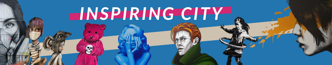
Carry on along the street until the junction with Wilkes Street and turn right. We are back in the heart of Huguenot London. The architecture here is unique and forms part of one of the largest conservation areas in Tower Hamlets. Here are some of the finest surviving examples of Georgian architecture. Soon you will come to Hanbury Street, turn right along it, heading back towards Brick Lane. Once you get to the junction, cross over and look around. We are now in the heart of the street art scene.
This section of Hanbury Street is known for it’s street art. Quality works from many artists can be seen there. One of the longest standing pieces is a giant work from Belgian artist ROA. It features an enormous black and white crane. The piece is well regarded by the local community. Cranes are revered creatures in the region of Bangladesh where many of the inhabitants of the area came from. Dotted around, you’ll see more street art by many different artists and it changes all the time.

Brick Lane to Shoreditch
Brick Lane has been around for a while, However it is unrecognisable now from it’s humble origins. Formerly just a field path running through open countryside on the outskirts of the City of London. It took it’s name from the clay pits along the lane where a brick manufacturing business began to develop. The lane would have transported the bricks to London, hence the name. The area around Brick Lane started to be really developed in the mid 1600’s. This was as a brewing industry moved into the area. It was also when the Huguenot refugees started to move in. Refugees fleeing the city after the Great Fire of London in 1666 also moved in. Looking to re-settle just outside the fire ravaged borders.

The Truman Brewery
Brewing played an important part in the history of the area. Many of the streets are named after people associated with the brewery. Eventually, it the mid 1800’s the brewery of Truman, Hanbury, Buxton and Co become one of the largest in London. As you’ve just been on Hanbury Street, there are no prizes for guessing who that particular street was named after.

If you are still on the side of Hanbury Street with the giant black and white ROA Crane. Turn right along Brick Lane and head up towards Shoreditch. This stretch of road is packed full of remnants of the brewing industry. The old Truman Brewery dominates the left hand side of the street. Now though it houses art workshops and exhibition spaces. Head up the street and you’ll soon see a sign depicting a black eagle. The black eagle was the symbol of the brewery. Once under the sign, look up and to the right, there you’ll see the old clock house. You’ll also see the towering chimney with the name ‘Truman’ written on. Brewing stopped at the site in 1988.

Brick Lane Market
Continuing our walking tour of the East End of London. Carry on up Brick Lane and you’ll notice that is a pretty busy place. Come market day it’s difficult to even walk down the street. This makes it even more bizarre when you see cars trying to get through. As you walk up Brick Lane there are plenty of detours if you want to see street art. Pedley Street, Grimsby Street, Scalter Street and Cheshire Street are all great places to look. Some of the best art around can be seen. You can read more about where to see street art here.

Jewish East London
Towards the top end of Brick Lane a further remnant of the Jewish presence in the area can be seen. This is in the form of the Beigel bakeries. Constantly with queues outside and food cooked in the Jewish style. These bakeries are a throw back to the time when this area was predominantly Jewish. The beigel was a key staple of the diet.
The first wave of real Jewish immigration to the area started in 1656. This was when Oliver Cromwell allowed Jews to settle. This was having previously been expelled from the country by Edward I in 1290. By the early 1700’s there was a sizeable population which expanded rapidly in the 1880’s. That was when persecution in Eastern Europe prompted more Jewish settlers to move into the area. The East End became known as the Jewish East End. If you look hard enough some of the evidence of these people can still be seen.

At the top of Brick Lane turn left and walk along Bethnal Green Road towards Shoreditch High Street station. Here you can really see the development of the area as the city expands. More and more people are moving into the area as it becomes more gentrified. New housing in the form of expensive flats are being built. Keep walking towards the station and try to glimpse what street art you can. There will be plenty to see from the left and the right. Soon you’ll come to BoxPark the innovative pop up shopping centre. This is home to many a trendy brand. It’s also where you’ll find the Shoreditch High Street Overground station.
Shoreditch to Liverpool Street
Walk to the end of the road and you’ll now be on Shoreditch High Street. Look left and the road eventually becomes Bishopsgate and enters the City of London. At one point, the entrance to the City would have been marked by an actual gate house. First built by the Romans it was expanded during medieval times until finally destroyed in 1760. The Bishopsgate would have been one of the seven main gates which entered the city. Look right and the road leads towards Cambridge and Lincoln and follows the route of the Roman Ermine Street, a major thoroughfare.
Cross over and look for Holywell Lane, a tiny little street with a Pret a Manger on the corner. Head up the lane until you come to a giant wall on the left.This is the Village Underground, an arts and cultural centre. If you look on the roof you’ll see four salvaged underground train carriages from the Jubilee Line. They now house offices and studio space for creative types.

Holywell Priory
This area is also rich in history and Holywell Lane takes it’s name from Holywell Priory. This was an Augustinian house of worship. It which would have stood here from around 1150 lasting until 1539 when it was dissolved by Henry VIII. The priory is believed to have been named after a Holy well which was within it’s grounds. The area would have had a number of natural springs given that it was marshland. It is from this area that those natural springs would also have formed the source of the River Walbrook. This is the river on which old Roman Londinium was founded.

Elizabethan Theatres
Walk to the end of the road and cross Great Eastern Street. Ahead is a big free standing car park. Walk towards the street called Curtain Road which is to the right of this and wander down. Here is a pub called the Horse and Groom. This pub is stood on the approximate location for the entrance to the Curtain Theatre. Built in 1577 it would have been contemporary with Shakespeare’s time. Indeed the likes of Romeo and Juliet and Henry V played there. Shakespeare himself is believed to have trod the boards as part of his troupe ‘The Lord Chamberlain’s Men’.
Shoreditch was at the heart of Elizabethan Theatre. About a 100 metres further down Curtain Road in the opposite direction to where we have been walking was another older venue called ‘The Theatre‘. The Theatre was built by the actor James Burbage and Shakespeare would have played here too. It is believed that the Theatre was dismantled on 28 December 1598. The timbers then transported to the South Bank to build what became the famous Globe Theatre.

Walbrook River
Continue down Curtain Road which actually follows the route of the Walbrook River. This is now hidden away as part of the city’s sewerage system. We need to turn left along Worship Street. However the old Walbrook would have continued straight forward towards Broadgate Circus. Then under the Bank of England and down by Cannon Street Station. At the end of Worship Street, cross the road and head to the right. This is Norton Folgate which will soon turn into Bishopsgate. Keep going, heading towards the towering view of the Gherkin. You will soon come to Liverpool Street which is where our tour started and where it now ends.

Lots of good info here and well worth a tour!!!
And we didn’t bump into each other! Excellent tour – thanks.
Great post. Finding ideas to write about is one of the hardest things about running a blog.
Thanks Stuart I’m glad you liked this one i’m planning to put another tour up soon 🙂
Did this on Friday 13th Jan 2017, very good indeed, made a walk through the area much more interesting. The street art is definitely worth a look